
Lake News Alerts
We'd like to send you lake news articles, videos, and podcasts from around the web.
 We will never share your email
|
Lakes in Georgia, United States
MAJOR LAKES
|
|
|
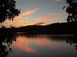
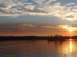
Lake Allatoona is a U.S. Army Corps of Engineers reservoir in Georgia, located in northwestern metro Atlanta. Red Top Mountain State Park is located on its shores, on the peninsula between the Etowah and Allatoona arms of the lake. Allatoona also supplies much of the drinking water for the three counties it is in. The lake is supplied mostly by the...
|
|
|
|
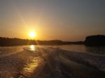
Lake Blackshear is a man-made lake on the Flint River in Georgia created by a dam that was constructed from 1925 to 1930. The Crisp County Power Dam, also known as the Warwick Dam, was the first county owned, constructed, and operated power dam in the United States, requiring an amendment to the Georgia State Constitution to make the project legall...


Full Pool: 237.0 MSL
Area: 8,500 Acres
|
|
|
|
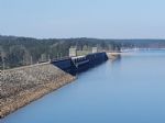
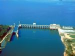
J. Strom Thurmond Lake, (also known as Clarks Hill Lake), is one of the top 10 most-visited Corps lakes in the nation and is the Largest U.S. Army Corps of Engineers Lake east of the Mississippi River.
The U.S. Army Corps of Engineers' J. Strom Thurmond Lake is a man-made lake bordering Georgia and South Carolina on the Savannah, Broad, and Litt...
|
|
|
|
Walter F. George Lake (Lake Eufaula) is a 45,000 acre lake located on the Chattahoocee River between the states of Alabama and Georgia. This area is rich in history with many nearby historic sites and towns. The lake is nationally known for it's bass and crappie fishing. The lock, located at Ft. Gaines, Georgia, has the second highest drop east of ...
|
|
|
|
Lake Harding, Ga | Lake Harding, Al., also known as Bartlett's Ferry Lake, is a 5,850-acre reservoir on the Chattahoochee River and is formed by Bartlett's Ferry Dam. Lake Harding is just north of Columbus, Ga. and east of Auburn, Al.
Rev. Simpson Wilson Bartley operated a ferry known as Bartley's Ferry on the Chattahoochee River and in 1926, B...
Full Pool: 521.0 MSL
Area: 5,860 Acres
|
|
|
|
Lake Hartwell is a reservoir bordering Georgia and South Carolina and is created by Hartwell Dam. As one of the southeast's largest and most popular recreation lakes, it is located on the Savannah River seven miles below the point at which the Tugaloo and Seneca Rivers join to form the Savannah. Extending 49 miles up the Tugaloo and 45 miles up the...
|
|
|
|
Lake Sidney Lanier, often referred to as Lake Lanier, is a reservoir in the northern portion of Georgia. Lake Lanier was created by the completion of Buford Dam on the Chattahoochee River in 1956, and is also fed by the waters of the Chestatee River. It was named for poet Sidney Lanier, and was built and is operated by the U.S. Army Corps of Engine...
|
|
|
|
Lake Oconee is a reservoir in central Georgia on the Oconee River, and is operated by Georgia Power. It was created in 1979 when Georgia Power completed the construction of the Wallace Dam. The lake is the forth largest in the state.
Upscale housing developments and resorts communities have been built on the banks of the lake since 1979. The lak...
|
|
|
|
Richard B. Russell Lake offers a rural, pristine and quiet setting with 21 public recreation areas, (8 in Georgia and 13 in South Carolina). Visitors enjoy a wide variety of recreational activities, including water sports, hunting, hiking, picnicking, camping, and fishing. Sound management of this resource protects and preserves the lake for future...
|
|
|
|
Lake Seminole is a reservoir located in the southwest corner of Georgia along its border with Florida. The Chattahoochee and Flint rivers join in the lake, before flowing from the Jim Woodruff Lock and Dam, which impounds the lake, as the Apalachicola River. Alligators, snakes and various waterfowl are present in Lake Seminole.
The Federal Gover...
Full Pool: 77.5 MSL
Area: 37,500 Acres
|
|
|
|
Lake Sinclair is a man-made lake in central Georgia near Milledgeville. It is operated by Georgia Power.
For day or weekend visitors, Georgia Power provides two public boat ramps for public access to water recreation. There are also marinas and boat storage areas located on the lake. There are other areas of access to the lake including Oconee S...
|
|
|
|
Lake Weiss (pronounced "Wice") is an Alabama Power Company hydroelectric impoundment covering 30,200 acres in northeast Alabama on the Alabama - Georgia border. The Weiss Lake fishery is the major economic influence in Cherokee County, so the locals treat anglers very well. Four free public access areas and 37 privately run marinas service Lake Wei...
|
|
|
|
Surrounded by deep forests and rolling fields, West Point Lake extends 35 miles along the Chattahoochee River on the Alabama-Georgia state line. The lake's 500 miles of shoreline provides excellent opportunities for fishing, camping, boating and other recreational activities.
The construction of West Point Dam was authorized by the Flood Control A...
|
|
|
|
OTHER LAKES IN GEORGIA
(alphabetical)
|
|
Lake Name
|
Full Pool *
(MSL) **
|
Acres
|
River
|
Map
|
|
Acworth
|
|
360
|
|
|
|
Arrowhead
|
|
540
|
|
|
|
Bear Creek
|
14,980.0
|
505
|
Bear River
|
|
|
Blue Ridge
|
1,681.0
|
3,300
|
Toccoa River
|
|
|
Blue Sluice
|
797.0
|
674
|
Chattahoochee River
|
|
|
Burton
|
|
2,775
|
|
|
|
Carters
|
1,074.0
|
3,200
|
|
|
|
Chatuge
|
1,925.0
|
3,930
|
|
|
|
Dog River
|
|
300
|
|
|
|
Goat Rock
|
404.0
|
940
|
Chattahoochee River
|
|
|
High Falls
|
|
650
|
|
|
|
Jackson
|
528.0
|
4,750
|
|
|
|
Laceola
|
|
120
|
|
|
|
Lambert
|
|
|
|
|
|
Long Pond
|
|
600
|
|
|
|
Lucerne
|
|
40
|
|
|
|
Mayers
|
|
170
|
|
|
|
Mountain Creek
|
|
|
|
|
|
Nottely
|
1,775.0
|
1,560
|
Nottely River
|
|
|
Oliver
|
337.0
|
2,150
|
Chattahoochee River
|
|
|
Pamona
|
|
101
|
|
|
|
Petit
|
|
110
|
|
|
|
Rabun
|
|
45
|
|
|
|
Seed
|
|
|
|
|
|
Sovereign
|
|
38
|
|
|
|
Spivey
|
|
500
|
|
|
|
Tara
|
|
275
|
|
|
|
Tchukolako
|
|
252
|
|
|
|
Tobesofkee
|
|
1,800
|
|
|
|
Tugalo
|
|
597
|
Tugaloo River
|
|
|
Walton
|
|
|
|
|
|
Wildwood
|
|
186
|
|
|
|
Yonah
|
|
325
|
|
|
* Full Pool - Highest normal summer pool level before flood stage
** MSL - Mean (average) feet above sea level
|
|


