
Lake News Alerts
We'd like to send you lake news articles, videos, and podcasts from around the web.
 We will never share your email
|
Lakes in North Carolina, United States
MAJOR LAKES
|
|

|
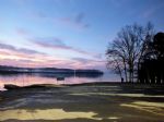
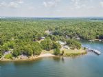
B. Everett Jordan Lake is a reservoir in New Hope Valley, west of Raleigh and south of Durham in Chatham County, North Carolina, in the United States of America. The northernmost end of the lake actually reaches into southwestern Durham County.
The reservoir was developed at an original cost of US $146,300,000 and is owned and operated by the Unit...
|
|
|
|
|
Badin Lake is one of a series of lakes created by the damming of the Yadkin-Pee Dee River in the Uwharrie Lakes Region of the United States. The Badin Lake Dam was built in 1917 to support a local aluminum smelting plant (Alcoa Aluminum Company of America), and the associated community of Badin was named for the founder, Adrien Badin. Badin Lake is...
|
|
|
|
|
Falls Lake is a 12,410 acre reservoir located in Durham, Wake, and Granville counties in North Carolina, USA. Falls Lake extends 28 miles up the Neuse River to its source at the confluence of the Eno, Little, and Flat rivers.
The lake is named for the Falls of the Neuse, a section of the Neuse River that falls from the Piedmont into the lower Coas...
|
|
|
|
|
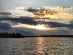
Lake Gaston is a hydroelectric reservoir in east United States of America. Part of the lake is in the North Carolina counties of Halifax, Northampton, and Warren. The part extending into Virginia lies in Brunswick and Mecklenburg counties. Lake Gaston is roughly 35 miles long and covers over 20,000 acres, with 350 miles of shoreline.
The area surr...
|
|
|
|
High Rock Lake is a reservoir lake located in the Davidson and Rowan counties of North Carolina, serving as a boundary between them. It is a reservoir for hydroelectric power generation. It is the northernmost of the Uwharrie Lakes and the second largest lake in North Carolina behind Lake Norman. Its water surface covers 15,180 acres and there are ...
|
|
|
|
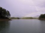
Hiwassee Lake is a reservoir located just 9.3 miles from Murphy, in Cherokee County, in the state of North Carolina, United States, near Hiwassee Village, NC. The reservoir serves recreational, power generation and flood control purposes. It is surrounded by the Nantahala and Cherokee National Forests and almost right next to the Appalachia Reserv...
|
|
|
|
|
Lake James is a large reservoir in the mountains of Western North Carolina which straddles the border between Burke and McDowell Counties. Lake James is named for James B. Duke, one of the founders of Duke Energy. Lake James has a surface area of approximately 6,812 acres, with 150 miles of shoreline. Full pond elevation is 1,200 feet.
Built over...
|
|
|
|
Lake Jocassee is a 7,500-acre, 300-foot deep reservoir located in northwest South Carolina created by the state in partnership with Duke Power in 1973. The lake is commonly known for the clean and cold Appalachian mountain rivers that feed the lake to keep its waters cool and clear year-round. The Jocassee Dam, which forms the lake, is 385 feet hig...


Full Pool: 100.0 Datum
Area: 7,565 Acres
|
|
|
|
|
Kerr Lake (officially John H. Kerr Reservoir, also known as Bugg's Island Lake) is a reservoir along the border of the U.S. states of North Carolina and Virginia created by the John H. Kerr Dam. The dam construction started in 1947 and took 2,100+ workers in three shifts, 24 hours a day, 365 days a year, more than four years to complete, and was fi...
|
|
|
|
|
Lake Mattamuskeet is the largest natural lake in North Carolina. It is a shallow coastal lake, averaging 2-3 feet in depth, and stretches 18 miles long and 7 miles wide. Lake Mattamuskeet lies on the Albemarle-Pamlico Peninsula.
Lake Mattamuskeet is the location of Mattamuskeet National Wildlife Refuge. This refuge as well as surrounding public ...
|
|
|
|
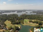
Lake Norman, created between 1959 and 1964 as part of the construction of the Cowans Ford Dam by Duke Energy, is the largest manmade body of fresh water located in North Carolina.
Lake Norman is fed by the Catawba River, and drains into Mountain Island Lake to the south. It was named after former Duke Power president Norman Cornelius. Lake Norma...
|
|
|
|
|
Lake Tillery is a reservoir between Badin Lake and Blewett Falls Lake in the Uwharrie Lakes Region of North Carolina. It is entirely within Stanly County and Montgomery County, NC. The lake was created by impounding the Pee Dee River, which is created by the confluence of the Yadkin River and the Uwharrie River several miles to the north. Norwood, ...
Full Pool: 278.0 MSL
Area: 5,260 Acres
|
|
|
|
|
Lake Waccamaw is a unique fresh water lake located in Columbus County in North Carolina. The lake is oval in shape measuring roughly 5.2 miles by 3.5 miles covering 8,938 acres surface area with an average depth of 7.5 feet and a shoreline of about 14 miles. The marginal 70% of the lake bottom is composed of clear sand, whereas the central 30% is ...
|
|
|
|
Lake Wylie is a reservoir, or man-made lake in the U.S. states of both South Carolina and North Carolina. The lake has a surface area of 13,400 acres and features 325 miles of shore line.
Lake Wylie's location on both the South Carolina and North Carolina borders makes it a common recreational destination for residents of nearby cities including C...
|
|
|
|
OTHER LAKES IN NORTH CAROLINA
(alphabetical)
|
|
Lake Name
|
Full Pool *
(MSL) **
|
Acres
|
River
|
Map
|
|
Adger
|
|
438
|
Green River
|
|
|
Bass
|
|
50
|
|
|
|
Belews
|
|
3,864
|
|
|
|
Calderwood
|
|
541
|
Little Tennessee River
|
|
|
Chatuge
|
1,925.0
|
3,930
|
|
|
|
Cheoah
|
|
|
Little Tennessee River
|
|
|
Fontana
|
1,710.0
|
4,480
|
Little Tennessee River
|
|
|
Glenville
|
3,491.0
|
1,470
|
West Fork Tuckasegee River
|
|
|
Harris
|
|
|
|
|
|
Hickory
|
99.0
|
4,223
|
North Fork Catawba River
|
|
|
Hyco
|
|
3,750
|
|
|
|
Lure
|
|
720
|
East Fork French Broad River
|
|
|
Mayo
|
|
2,800
|
|
|
|
Mountain Island
|
647.5
|
3,281
|
Catawba River
|
|
|
Nantahala
|
|
1,605
|
Nantahala River
|
|
|
Oak Hollow
|
|
810
|
|
|
|
Osceola
|
|
|
|
|
|
Rhodhiss
|
95.0
|
3,060
|
Left Prong Catawba River
|
|
|
Royale
|
|
345
|
|
|
|
Santeetlah
|
1,815.0
|
2,881
|
Cheoah River
|
|
|
Toxaway
|
|
|
|
|
|
Upchurches
|
|
|
|
|
|
W. Kerr Scott
|
|
1,475
|
Yadkin River
|
|
|
Wildcat
|
|
13
|
|
|
* Full Pool - Highest normal summer pool level before flood stage
** MSL - Mean (average) feet above sea level
|
|


